MysCad Geomatic Design Office (MysCad GDO) is software which contains sophisticated design modules such as road design, earth work design, pipe line design, parcel design, transmission design and so on. Furthermore, this software is Malays and English character sets supported. Besides, it also CAD supported software. With this software, operators can work in one system from start to finish which mean operators only learn one system instead of 2 or more. Our aim is to provide fast, user friendly and complete with more design options so that the operators can complete the final design on time, no budget, increased productivity and reduced cost. In directly, your company can win more business. This software is suitable to those expert groups who are in engineering, consulting, surveying and any relevant fields.
Features:
Volume Design
5 Method of Volume Calculation by End Area, Trapezoinal or Traingulation method.
Comply Land &Survey Volume Calculation & Submission
Proposed platform level design with user definable slope cut
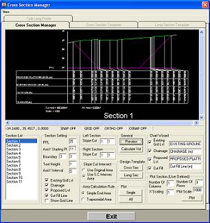
Automatic or Manual Long Section and Cross Section drawing calculation
Road design
Horizontal and Vertical alignment with traditional or coordinate Method
Horizontal and Vertical Curve design such as spiral, circular curve, transition curve
Profiles design with Volume generation and LongSection & Cross Section Templates
3D perspectives view
Pipeline design
Design pipe line by manually or vertical selection
Split Pipeline Profile (by sections)
Pipeline Profile design and info generation
Drainage Design
Design Drainage line by manually or vertical selection
Split Drainage Profile (by sections)
Drainage Profile design and info generation
Transmission line design
Design the transmission line graphically
Orientate the transmission line
Add on the design details through Input Panel
Profile design and details generation
Parcel Design
Graphically Draw or edit the parcel
Direct input the coordinates and relevant information using Input Panel
Add on parcel information
Perform open traverse adjustment and close traverse adjustment
Comprehensive traverse reports
3D Analysis
Slope, Elevation, ISOZone, Mash Analysis
Complete 3D view with multiple rendering method
Key Benefits:
MysCad is a full featured Windows based CAD system, focusing exclusively on the special needs of civil engineers, surveyors, construction contractors, and mapping professionals.
Work in one system from start to finish which mean operators only learn one system instead of 2 or more.
Sophisticated design office which mean operators can complete the final design faster.
More design options can increase the productivity and reduced cost.
Reduced re-design work which mean the operators can complete the design on time and on budget.
Full support and generation on require deliverables and relevant reports.