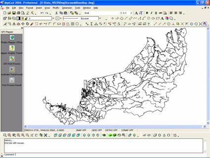
MysCad GPS Mapper comes with of the off the shelf ready base map in CAD/GIS format, which ready to used. It completed with major terrain spatial informations, which ease to update and edit the captured GPS data.
Features:
Come with of the off the shield ready base map in CAD/GIS format, which ready to used. Completed with major terrain spatial informations, which ease to update and edit the captured GPS data.
Direct support for most Garmin GPS product range.
Download Waypoints, Routes and Tracks from your GPS and display them on a map.
Completed with single point processing wizard to enhance the GPS accuracy.
Completed with ready standard CAD tools which can used to edit and modify the downloaded GPS route and waypoint.
The System must support English & Malays GUI.
Support Borneo RSO.
Support on the fly transformation for CAD drawing.
Comply Malaysia’s state coordinate transformation tools (WGS84, BT68, MRT, RSO and Cassini projection).
Waypoints, routes and tracks created or collected by your GPS during your travels can be downloaded, post process and viewed on the map.
Provide the CAD functionality to edit and save to the data in the computer.
Direct saving in CAD dwg, vdf format.
Support import and export for Arcview shape files, E00 files, CAD dwg, dxf, vdf and other industry standard format.
Key Benefits:
Direct support for most Garmin GPS product range.
Support GPS Adjustment and provide better accuracy for Low Cost GPS Mapping.
Support Low Cost GPS Data post processing, vector adjustment and provide better accuracy.
Support Borneo RSO.
Comply of Malaysia’s State Coordinate Transformation Tools (WGS84, BT68, MRT, RSO and Cassini projection).
Downloadable Waypoints, Routes and Tracks from GPS.
Dynamic Link between CAD drawing and GPS Mapper – Enable the user to view and plot Waypoints, Routes and Tracks as a references from post processed GPS data.
Provide CAD functionality to edit and save data.
Provide accuracy and data integrity with a single point based coordinate system.
Support DXF, DWG, VDI, VDF, JPG, WMF, BMP, and other industry standard formats for drawing.
Support import and export for Arcview shape files, E00 files, CAD dwg, dxf, vdf and other industry standard format.